Explore New Brunswick’s Atlantic salmon and trout water: the Miramichi and its branches, the Restigouche, Nepisiguit and Saint John, with Crown Reserve stretches, guide-required and fly-only water, closed pools, this season’s stocked lakes, Crown land, boat launches, river gauges and the Recreational Fishing Area for each water.
Mapped waters
3,993
Nearby access facilities
Check before you fish. Access, stocking and regulations here come from New Brunswick's own data and can be out of date. Posted signs and landowners' wishes come first, and private land needs permission. The rules that apply are in the New Brunswick Fish regulations summary, and you need a valid fishing license.
Filters
Filter streams
3,993 waters
Map layers
Background
Light map in dark modeEasier to read in sunshine, and rivers stay visible.
Layers
Atlantic salmon water
Trout water (named)
Landlocked salmon water
Crown Reserve water
Guide required
Restricted gear
Closed to angling
Stocked lakes
Bold where the stream crosses public land; faint and dashed across private land. Gauges are measurement stations; a nearby gauge may be on a different stream.
Stream types · New Brunswick
Atlantic salmon water
Trout water (named)
Landlocked salmon water
Crown Reserve water
Guide required
Restricted gear
Closed to angling
Stocked lakes
Public land
Bold where the stream crosses public land
Legend & map details
Atlantic salmon waterTrout water (named)Landlocked salmon waterCrown Reserve waterGuide requiredRestricted gearClosed to anglingStocked lakesNot public landPublic landFishing accessLaunchRiver gauge, conditions today: good fair poor no verdict; a group takes its worst gauge's colorRiver gauge, flow for the date: low below normal above high no reading
Fish on your own. Guide prices are optional; check licence, permit and access requirements before going.
JFMAMJJASOND
Guide, per angler
$211
Public access
Limited
Crowding
Low
Guided days are sold per angler and usually come with lodging; non-residents must hire a guide
How to read this map
Layers, public land, access and sources
Rivers are drawn from the province’s fishing regulations map: Atlantic salmon water, trout water and landlocked salmon water as the regulations classify them. Wide rivers mapped as areas are drawn along their centre.
Crown Reserve stretches are fished by reservation only (through the province’s draw and daily booking), and on some waters non-residents need a licensed guide. Restricted-gear stretches are fly fishing only or have other gear limits. Closed stretches are closed to all angling, often cold-water pools that protect salmon in summer.
Salmon seasons are listed water by water in the New Brunswick Fish summary and change by river section; each water links its Recreational Fishing Area page. Atlantic salmon fishing is fly only and, on most waters, catch-and-release. The province can close rivers at short notice when water is warm or low, so check the current warm-water closures before you go.
Public land is Crown land, provincial parks, protected natural areas and the national parks, without private land and Crown angling leases. Much salmon frontage is private or leased, so a river crossing Crown land doesn’t mean every bank is open. Access markers are the province’s boat launches.
Highlighted banks adjoin mapped open-access public land, with a roughly 20-meter bank tolerance. Dimmed water has no adjacent open-access parcel recorded in this source. Neither determines legal entry, rights of way or permission to cross private land. Check signs, property rules and the current fishing regulations.
Access markers are source facility locations within about 800 meters of mapped water, not verified parking spaces or guaranteed entry to a particular reach. River-gauge readings describe the gauged location; a nearby gauge on another stream is shown as context.
Public land: New Brunswick Crown lands, provincial parks and protected natural areas (GeoNB), and national parks; private land and Crown angling leases excluded. Regions: New Brunswick counties. Gauges: Water Survey of Canada. Contains information licensed under the Open Government Licence – New Brunswick and the Open Government Licence – Canada.
Downloaded October 26, 2026; underlying observations and geometry can be older. Map tiles: OpenFreeMap and OpenStreetMap contributors.
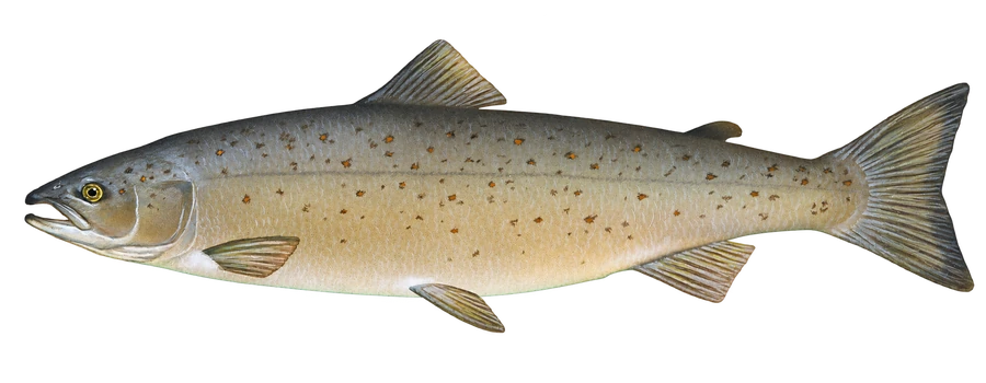 Atlantic salmonAtlantic salmon, grilse, sea-run brook trout