Explore Arkansas’s trout tailwaters and spring rivers — the White River below Bull Shoals and Beaver dams, the Norfork, the Little Red, the Spring River, the Little Missouri and the winter trout below the Ouachita dams — by AGFC’s 2026 limit zones, with public land, AGFC access and river gauges.
Mapped waters / sections
9
Nearby access facilities
Check before you fish. Access, stocking and regulations here come from Arkansas's own data and can be out of date. Posted signs and landowners' wishes come first, and private land needs permission. The rules that apply are in the AGFC fishing regulations, and you need a valid fishing license.
Filters
Filter streams
9 streams
Map layers
Background
Light map in dark modeEasier to read in sunshine, and rivers stay visible.
Layers
2 rainbows under 14 in
2 trout, 1 over 14 in
2 trout, release over 14 in
Trout water (statewide limits)
Winter trout (Nov–Apr)
Bold where the stream crosses public land; faint and dashed across private land. Gauges are measurement stations; a nearby gauge may be on a different stream.
Stream types · Arkansas
2 rainbows under 14 in
2 trout, 1 over 14 in
2 trout, release over 14 in
Trout water (statewide limits)
Winter trout (Nov–Apr)
Public land
Bold where the stream crosses public land
Legend & map details
2 rainbows under 14 in2 trout, 1 over 14 in2 trout, release over 14 inTrout water (statewide limits)Winter trout (Nov–Apr)Not public landPublic landFishing accessLaunchRiver gauge, conditions today: good fair poor no verdict; a group takes its worst gauge's colorRiver gauge, flow for the date: low below normal above high no reading
Fish on your own. Guide prices are optional; check licence, permit and access requirements before going.
JFMAMJJASOND
Guide, per angler
$275–300
Public access
Moderate
Crowding
Medium
How to read this map
Layers, public land, access and sources
Arkansas publishes no map layer of its trout water, so the reaches are the Arkansas DEQ’s designated trout streams and the zones follow AGFC’s 2026 trout limits: two rainbows under 14 inches from Bull Shoals Dam to the Norfork Access and on the Norfork; two trout with one over 14 inches from the Norfork Access to the Highway 58 bridge at Guion; and two trout with any over 14 inches released on the Beaver and Greers Ferry tailwaters. Each section is traced on USGS 3D Hydrography channels between those points.
The tailwaters rise and fall with dam releases: check the generation schedule before wading. AGFC stocks the Ouachita tailwaters below Blakely, Carpenter and Remmel dams from November through April but doesn’t publish their limits, so the map draws the first 3 km below each dam.
Highlighted banks adjoin mapped open-access public land, with a roughly 20-meter bank tolerance. Dimmed water has no adjacent open-access parcel recorded in this source. Neither determines legal entry, rights of way or permission to cross private land. Check signs, property rules and the current fishing regulations.
Access markers are source facility locations within about 800 meters of mapped water, not verified parking spaces or guaranteed entry to a particular reach. River-gauge readings describe the gauged location; a nearby gauge on another stream is shown as context.
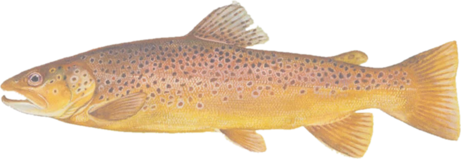 Brown troutBrown trout (including very large fish), rainbows, cutthroat, brook trout